Geolocate

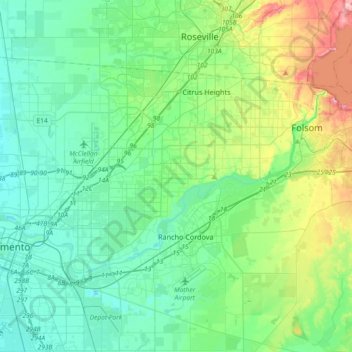
American River topographic map

Click on the map to display elevation.

American River

The North Fork is the longest tributary of the American River, at 88 miles (142 km). It begins at an elevation of about 7,900 feet (2,400 m) near Lake Tahoe in Placer County at Mountain Meadow Lake, just northeast of Granite Chief and immediately due west of Palisades Tahoe (formerly Squaw Valley) Ski Resort. It flows westward through remote wilderness areas.

Wikipedia (CC-BY-SA 3.0)

About this map

Name: American River topographic map, elevation, terrain.

Location: American River, Rancho Cordova, Sacramento County, California, United States (38.55950 -121.50842 38.71713 -121.14152)

Average elevation: 44 m

Minimum elevation: 0 m

Maximum elevation: 197 m

Gear up for your next adventure:

🛌Down Sleeping Bag - Superior warmth-to-weight ratio for cold nights
Family Camping Tent - Spacious tent suitable for family camping trips
🩹Moleskin Blister Pads - Direct protection for painful foot pressure points
🧼Biodegradable Camp Soap - Environmentally friendly cleaning for gear and body
💡Compact LED Flashlight - Powerful and portable flashlight for outdoor use

As an Amazon Associate, this site earns from qualifying purchases at no extra cost to you.