Geolocate

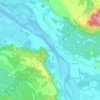
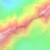
Fox Glacier topographic map

Click on the map to display elevation.

Fox Glacier

Although Fox Glacier regained about 300 m of length during its last advance phase, it has retreated more than 3 km since the 1880s. Fox Glacier is highly sensitive to climate variability because of its steep mass-balance gradient and large, high-elevation accumulation area, and its terminus responds rapidly to changes in mass balance, with an estimated response time of 3 to 9 years.

Wikipedia (CC-BY-SA 3.0)

About this map

Name: Fox Glacier topographic map, elevation, terrain.

Location: Fox Glacier, Westland District, West Coast, New Zealand (-43.53543 170.06385 -43.49899 170.16953)

Average elevation: 1,848 m

Minimum elevation: 718 m

Maximum elevation: 3,040 m

Other topographic maps

Click on a map to view its topography, its elevation and its terrain.
Hokitika

New Zealand > West Coast > Westland District

Average elevation: 14 m

Haast

New Zealand > West Coast > Westland District

Average elevation: 15 m

Arthur's Pass

New Zealand > West Coast > Westland District

Average elevation: 1,148 m

Franz Josef

New Zealand > West Coast > Westland District

Average elevation: 264 m

Otira

New Zealand > West Coast > Westland District

Average elevation: 887 m

Kumara

New Zealand > West Coast > Westland District

Average elevation: 73 m

Mount Tasman

New Zealand > West Coast > Westland District

Average elevation: 2,798 m

Mount Haast

New Zealand > West Coast > Westland District

Average elevation: 2,643 m

Mount Aspiring

New Zealand > West Coast > Westland District

Mount Aspiring / Tititea is New Zealand's 23rd-highest mountain. The peak's altitude of 3,033 metres (9,951 ft) makes it the country's highest outside the Aoraki / Mount Cook National Park region.

Average elevation: 2,257 m

La Perouse

New Zealand > West Coast > Westland District

Average elevation: 2,303 m

Lake Ellery

New Zealand > West Coast > Westland District

Average elevation: 184 m

Ivory Glacier

New Zealand > West Coast > Westland District

Average elevation: 1,635 m

Mount Lycia

New Zealand > West Coast > Westland District

Average elevation: 1,367 m

Whataroa

New Zealand > West Coast > Westland District

Average elevation: 70 m

Arthur's Pass

New Zealand > West Coast > Westland District

Average elevation: 1,148 m

Franz Josef

New Zealand > West Coast > Westland District

Average elevation: 264 m

Kumara

New Zealand > West Coast > Westland District

Average elevation: 73 m

Waiatoto

New Zealand > West Coast > Westland District

Average elevation: 11 m

Franz Josef

New Zealand > West Coast > Westland District

Average elevation: 277 m

Haast

New Zealand > West Coast > Westland District

Average elevation: 15 m

Mount Harry

New Zealand > West Coast > Westland District

Average elevation: 113 m

Whataroa

New Zealand > West Coast > Westland District

Average elevation: 70 m

De La Beche

New Zealand > West Coast > Westland District

Average elevation: 2,480 m

Coronet

New Zealand > West Coast > Westland District

Average elevation: 2,173 m

Mount Lycia

New Zealand > West Coast > Westland District

Average elevation: 1,367 m

Hidden Peak

New Zealand > West Coast > Westland District

Average elevation: 1,877 m

Gear up for your next adventure:

🧥Insulated Jacket - Keep warm in cold outdoor conditions
🥾Lightweight Hiking Shoes - Comfortable shoes for day hikes
🛰️Satellite Messenger - Emergency communication for areas with no cell service
🧥Softshell Jacket - Windproof and breathable jacket for hiking
🧼Biodegradable Camp Soap - Environmentally friendly cleaning for gear and body

As an Amazon Associate, this site earns from qualifying purchases at no extra cost to you.