Geolocate

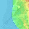
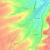
Renty topographic map

Click on the map to display elevation.

About this map

Name: Renty topographic map, elevation, terrain.

Location: Renty, Saint-Omer, Pas-de-Calais, Hauts-de-France, Metropolitan France, 62560, France (50.55132 2.03085 50.60292 2.10462)

Average elevation: 134 m

Minimum elevation: 73 m

Maximum elevation: 187 m

Other topographic maps

Click on a map to view its topography, its elevation and its terrain.

Panehem

France > Hauts-de-France > Pas-de-Calais > Samer

Average elevation: 70 m

Le Petit Vimy

France > Hauts-de-France > Pas-de-Calais > Vimy

Average elevation: 93 m

Noyelles

France > Hauts-de-France > Pas-de-Calais > Bours

Average elevation: 125 m

Gear up for your next adventure:

🥾Lightweight Hiking Shoes - Comfortable shoes for day hikes
🧦Crew Hiking Socks - Comfortable socks for long-distance hikes
❄️Traction Ice Cleats - Slip-on spikes for icy trails and winter hiking
🧊Insulated Water Bottle - Keeps drinks cold in summer and prevents freezing in winter
🧥Thermal Layer - Insulating layer for cold outdoor conditions

As an Amazon Associate, this site earns from qualifying purchases at no extra cost to you.