Geolocate

Croston topographic map

Click on the map to display elevation.

About this map

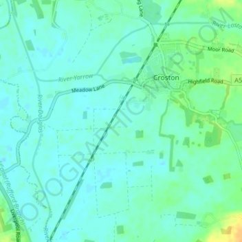
Name: Croston topographic map, elevation, terrain.

Location: Croston, Chorley, Lancashire, England, United Kingdom (53.63953 -2.81675 53.67118 -2.75202)

Average elevation: 8 m

Minimum elevation: 2 m

Maximum elevation: 28 m

Other topographic maps

Click on a map to view its topography, its elevation and its terrain.

Wymott

United Kingdom > England > Lancashire > Chorley

Average elevation: 17 m

Gear up for your next adventure:

💡Portable Camping Lamp - Rechargeable lamp for campsite lighting
🥾All-Terrain Hiking Boots - Versatile boots for varied hiking conditions
💡Compact LED Flashlight - Powerful and portable flashlight for outdoor use
🧦Hiking Socks - Moisture-wicking and comfortable socks for long hikes
🥾Approach Boots - Comfortable boots for hiking and climbing approaches

As an Amazon Associate, this site earns from qualifying purchases at no extra cost to you.