Geolocate

Clover topographic map

Click on the map to display elevation.

About this map
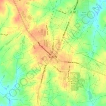
Name: Clover topographic map, elevation, terrain.

Location: Clover, York County, South Carolina, United States (35.09346 -81.24254 35.13183 -81.20580)

Average elevation: 234 m

Minimum elevation: 208 m

Maximum elevation: 254 m

Other topographic maps

Click on a map to view its topography, its elevation and its terrain.

Gear up for your next adventure:

🏃Hydration Running Vest - Carry water and maps close to your body for speed
🌬️Windproof Camp Stove - Efficient cooking even on exposed mountain peaks
🎒Backpack Rain Cover - External shield to keep your entire pack dry
🧭GPS Outdoor Watch - Smart watch for navigation and fitness tracking in nature
🧰Multitool Knife - Compact and versatile tool for outdoor use

As an Amazon Associate, this site earns from qualifying purchases at no extra cost to you.