Geolocate

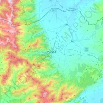
Florina topographic map

Click on the map to display elevation.

Florina

Florina is one of the coldest towns in Greece, because of its elevation and geographic position. Heavy snowfalls, thick fog and below-freezing temperatures are common during the winter months, while the summers are mild. Under the Köppen climate classification, Florina has a humid subtropical climate (Cfa) with strong hot-summer continental climate (Dfa) influences.

Wikipedia (CC-BY-SA 3.0)

About this map

Name: Florina topographic map, elevation, terrain.

Location: Florina, Florina Municipal Unit, Municipality of Florina, Florina Regional Unit, Western Macedonia, Epirus and Western Macedonia, 531 00, Greece (40.62290 21.25389 40.94290 21.57389)

Average elevation: 999 m

Minimum elevation: 574 m

Maximum elevation: 2,319 m

Gear up for your next adventure:

🥾Mountain Hiking Boots - High-traction boots for rocky terrain
🧴Outdoor Sunscreen - High SPF protection for high-altitude UV exposure
🥽Outdoor Goggles - Protective eyewear for outdoor activities
Backpacking Tent - Lightweight tent for long-distance hiking trips
🔭Compact Binoculars - Lightweight optics for scouting trails and wildlife

As an Amazon Associate, this site earns from qualifying purchases at no extra cost to you.