Geolocate

Beau Fraisier topographic map

Click on the map to display elevation.

About this map
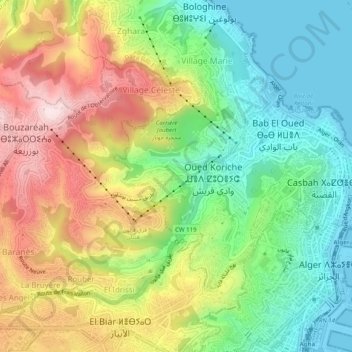
Name: Beau Fraisier topographic map, elevation, terrain.

Location: Beau Fraisier, Bab El Oued District, Algiers, 16606, Algeria (36.76604 3.01859 36.80604 3.05859)

Average elevation: 166 m

Minimum elevation: -2 m

Maximum elevation: 399 m

Other topographic maps

Click on a map to view its topography, its elevation and its terrain.

Casbah

Algeria > Algiers > Bab El Oued District

Average elevation: 52 m

Bulughin

Algeria > Algiers > Bab El Oued District

Average elevation: 81 m

Gear up for your next adventure:

⛺Camping Essentials - All-in-one gear for a comfortable camping trip
💧Hydration Bladder - Hands-free hydration solution for long treks
🧳Compression Sacks - Maximize space in your backpack by shrinking gear
🧥Ultralight Puffy Jacket - Maximum warmth that packs down to the size of an orange
❄️Traction Ice Cleats - Slip-on spikes for icy trails and winter hiking

As an Amazon Associate, this site earns from qualifying purchases at no extra cost to you.