
Thank you for supporting this site ❤️
Make a donation
Make a donation
Gear up for your next adventure:
As an Amazon Associate, this site earns from qualifying purchases at no extra cost to you.
Carway topographic map
Click on the map to display elevation.
Thank you for supporting this site ❤️
Make a donation
Make a donation
Gear up for your next adventure:
As an Amazon Associate, this site earns from qualifying purchases at no extra cost to you.
About this map
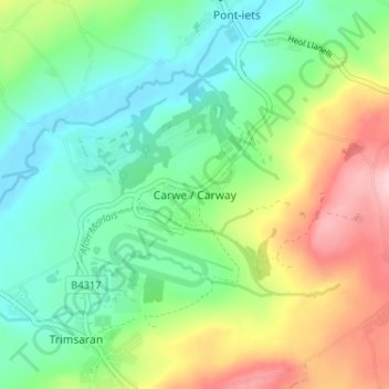
Name: Carway topographic map, elevation, terrain.
Location: Carway, Carmarthenshire, Wales, SA17 4HL, United Kingdom (51.71587 -4.24564 51.75587 -4.20564)
Average elevation: 75 m
Minimum elevation: 4 m
Maximum elevation: 211 m
Thank you for supporting this site ❤️
Make a donation
Make a donation
Gear up for your next adventure:
As an Amazon Associate, this site earns from qualifying purchases at no extra cost to you.