
Nezahualcóyotl topographic map
Interactive map
Click on the map to display elevation.
Nezahualcóyotl
The municipality has a territory of 63.44 km2, 81% of which is occupied by the city, which consists of 86 neighborhoods called colonias. The rest is part of the Federal Zone of the Ex-Basin of Texcoco. The municipality is flat with only one elevation reading 1,220 meters above sea level. The Los Remedios and a brand of the Churubusco River run through here. At the far northeast is a remnant of Lake Texcoco and an artificial lake was built here as part of the Parque del Puebla to serve as an ecological reserve. The climate is temperate with a fairly cold winter and rain mostly falling between June and October. Average temperature is about 15C with temperatures as high as 34C and as low as −5C. The area has little to no native wild flora and fauna due to the fact that it was underwater until the 20th century and the area is nearly completely urbanized. However, in winter a number of bird species such as cranes and storks pass through.
About this map
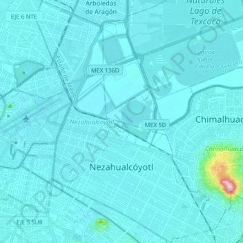
Name: Nezahualcóyotl topographic map, elevation, terrain.
Location: Nezahualcóyotl, State of Mexico, Mexico (19.36621 -99.06799 19.49878 -98.96587)
Average elevation: 2,235 m
Minimum elevation: 2,220 m
Maximum elevation: 2,536 m
Other topographic maps
Click on a map to view its topography, its elevation and its terrain.
Valle de Bravo
Mexico > State of Mexico > Valle de Bravo
The municipality is surrounded by mountain ranges and other elevated areas covering about 50% of the total area and include the Sierra de Temascaltepec, Sierra de Tenayac, Sierra de Valle de Bravos as wells as the hills that roll around the mountain ranges. These elevations include a number of small volcanoes…
Average elevation: 1,914 m