Geolocate

Cabanes topographic map

Click on the map to display elevation.

About this map

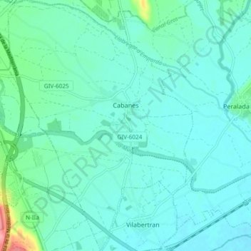
Name: Cabanes topographic map, elevation, terrain.

Location: Cabanes, Upper Empordà, Girona, Catalonia, 17761, Spain (42.27696 2.94173 42.33156 2.99624)

Average elevation: 28 m

Minimum elevation: 12 m

Maximum elevation: 111 m

Other topographic maps

Click on a map to view its topography, its elevation and its terrain.

Montgó

Spain > Catalonia > Upper Empordà > l'Escala

Average elevation: 17 m

Darnius

Spain > Catalonia > Upper Empordà > Darnius > Darnius

Average elevation: 208 m

Gear up for your next adventure:

🧢Hiking Hat - Sun-protective and breathable hats for long treks
💧Filtered Water Bottle - Safe drinking water on the go
🏕️Camping Hammock - Integrated protection for sleeping between trees
🥾Light Trekking Boots - Supportive boots for multi-day treks
🎒Backpack Rain Cover - External shield to keep your entire pack dry

As an Amazon Associate, this site earns from qualifying purchases at no extra cost to you.