Geolocate

Yate topographic map

Click on the map to display elevation.

About this map
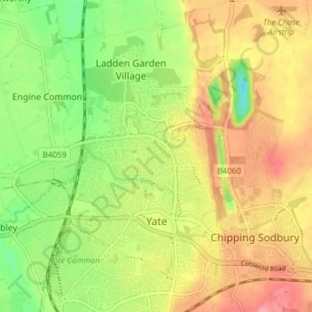
Name: Yate topographic map, elevation, terrain.

Location: Yate, South Gloucestershire, West of England, England, United Kingdom (51.52837 -2.43639 51.56935 -2.38249)

Average elevation: 83 m

Minimum elevation: 37 m

Maximum elevation: 126 m

Other topographic maps

Click on a map to view its topography, its elevation and its terrain.

Gear up for your next adventure:

🧢Outdoor Cap - Protective cap for sun and rain during hikes
🧊Insulated Water Bottle - Keeps drinks cold in summer and prevents freezing in winter
🥾Durable Hiking Shoes - Long-lasting shoes for frequent hiking
🧢Beanie Hat - Keep your head warm in cold weather
🎒Backpack Rain Cover - External shield to keep your entire pack dry

As an Amazon Associate, this site earns from qualifying purchases at no extra cost to you.