
Thank you for supporting this site ❤️
Make a donation
Make a donation
Gear up for your next adventure:
As an Amazon Associate, this site earns from qualifying purchases at no extra cost to you.
Welimada topographic map
Click on the map to display elevation.
Thank you for supporting this site ❤️
Make a donation
Make a donation
Gear up for your next adventure:
As an Amazon Associate, this site earns from qualifying purchases at no extra cost to you.
About this map
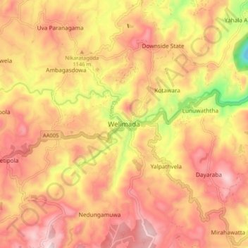
Name: Welimada topographic map, elevation, terrain.
Location: Welimada, Badulla District, Uva Province, 90350, Sri Lanka (6.86584 80.86981 6.94584 80.94981)
Average elevation: 1,127 m
Minimum elevation: 795 m
Maximum elevation: 1,332 m
Thank you for supporting this site ❤️
Make a donation
Make a donation
Gear up for your next adventure:
As an Amazon Associate, this site earns from qualifying purchases at no extra cost to you.