Geolocate

Oss topographic map

Click on the map to display elevation.

About this map

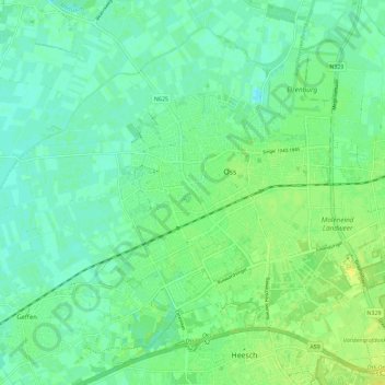
Name: Oss topographic map, elevation, terrain.

Location: Oss, North Brabant, Netherlands (51.73094 5.45972 51.79912 5.57376)

Average elevation: 8 m

Minimum elevation: -2 m

Maximum elevation: 18 m

Other topographic maps

Click on a map to view its topography, its elevation and its terrain.

Lennisheuvel

Netherlands > North Brabant > Boxtel

Average elevation: 9 m

Bobby's beach

Netherlands > North Brabant > Helmond

Average elevation: 20 m

Gear up for your next adventure:

🐕Hiking Dog Pack - Let your canine companion carry their own water and food
🧥Waterproof Hiking Jacket - Protect yourself from rain and wind while hiking
🥤Collapsible Travel Cup - Saves space and weight in your mess kit
🧰Emergency Multi-Tool - Compact multi-tool for outdoor survival
💡LED Camping Lantern - Illuminate your campsite with long-lasting lanterns

As an Amazon Associate, this site earns from qualifying purchases at no extra cost to you.