Geolocate

Dima topographic map

Click on the map to display elevation.

About this map

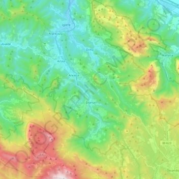
Name: Dima topographic map, elevation, terrain.

Location: Dima, Biscay, Autonomous Community of the Basque Country, 48141, Spain (43.03344 -2.77887 43.18507 -2.66308)

Average elevation: 501 m

Minimum elevation: 72 m

Maximum elevation: 1,478 m

Other topographic maps

Click on a map to view its topography, its elevation and its terrain.

Gear up for your next adventure:

🍽️Titanium Camping Spork - Ultralight and indestructible eating utensil
🚲Bike Repair Kit - Essential tools for on-trail mechanical issues
🎒Hiking Daypack - Lightweight and durable backpacks for day trips and excursions
🧤Thermal Hiking Gloves - Grip-enhanced gloves for cold-weather altitude trekking
🥾Light Hiking Boots - Lightweight and comfortable boots for day hikes

As an Amazon Associate, this site earns from qualifying purchases at no extra cost to you.