

Bhilwara topographic map
Click on the map to display elevation.
Bhilwara
Bhilwara is located at 25°21′35″N 74°39′10″E / 25.359854°N 74.652791°E / 25.359854; 74.652791. It has an average elevation of 421 metres (1381 feet). It falls between the districts of Ajmer (in the north) and Chittorgarh and Udaipur (in the south). Major rivers flowing through the district are Banas, Bedach, Kothari, Khari, Mansi, Menali, Chandrabhaga, and Nagdi.
About this map
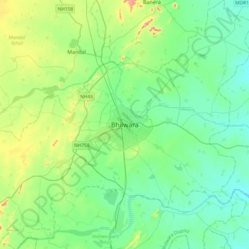
Name: Bhilwara topographic map, elevation, terrain.
Location: Bhilwara, Bhilwara Tehsil, Bhilwara, Rajasthan, 311001, India (25.18800 74.47600 25.50800 74.79600)
Average elevation: 426 m
Minimum elevation: 379 m
Maximum elevation: 586 m