
Kortemark topographic map
Interactive map
Click on the map to display elevation.
About this map
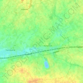
Name: Kortemark topographic map, elevation, terrain.
Location: Kortemark, Diksmuide, West Flanders, Flanders, Belgium (51.00211 3.00606 51.06089 3.07011)
Average elevation: 15 m
Minimum elevation: -13 m
Maximum elevation: 29 m