Geolocate

Cuadonga / Covadonga topographic map

Click on the map to display elevation.

About this map

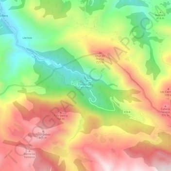
Name: Cuadonga / Covadonga topographic map, elevation, terrain.

Location: Cuadonga / Covadonga, Cangas de Onís, Asturias, 33589, Spain (43.28799 -5.07180 43.32799 -5.03180)

Average elevation: 504 m

Minimum elevation: 121 m

Maximum elevation: 883 m

Other topographic maps

Click on a map to view its topography, its elevation and its terrain.

Cuadonga / Covadonga

Spain > Asturias > Cangas de Onís

Average elevation: 503 m

Gear up for your next adventure:

🪑Ultralight Camping Stool - Compact seating for rest stops during long hikes
❄️Traction Ice Cleats - Slip-on spikes for icy trails and winter hiking
🧢Sun Protection Cap - Breathable cap to protect from sun exposure
🧥Waterproof Hiking Jacket - Protect yourself from rain and wind while hiking
🎒Backpack Rain Cover - External shield to keep your entire pack dry

As an Amazon Associate, this site earns from qualifying purchases at no extra cost to you.