
Thank you for supporting this site ❤️
Make a donation
Make a donation
Gear up for your next adventure:
As an Amazon Associate, this site earns from qualifying purchases at no extra cost to you.
Annaberg-Buchholz topographic map
Click on the map to display elevation.
Thank you for supporting this site ❤️
Make a donation
Make a donation
Gear up for your next adventure:
As an Amazon Associate, this site earns from qualifying purchases at no extra cost to you.
About this map
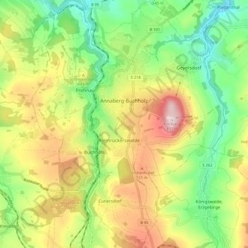
Name: Annaberg-Buchholz topographic map, elevation, terrain.
Location: Annaberg-Buchholz, Erzgebirgskreis, Saxony, 09456, Germany (50.53812 12.97035 50.60662 13.05432)
Average elevation: 609 m
Minimum elevation: 444 m
Maximum elevation: 835 m
Thank you for supporting this site ❤️
Make a donation
Make a donation
Gear up for your next adventure:
As an Amazon Associate, this site earns from qualifying purchases at no extra cost to you.