

Vallorbe topographic map
Click on the map to display elevation.
Vallorbe
The municipality is located on the Swiss-French border. It is surrounded on three sides with mountains and reaches from 610 to 1,480 m (2,000 to 4,860 ft) in elevation. On the east side, the valley opens up due to the Jougnenaz and Orbe rivers. It includes the hamlets of Le Day, Le Creux and Bellevue.
About this map
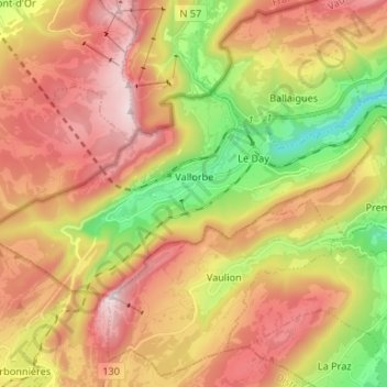
Name: Vallorbe topographic map, elevation, terrain.
Location: Vallorbe, District du Jura-Nord vaudois, Vaud, 1337, Switzerland (46.68399 6.30727 46.73189 6.43979)
Average elevation: 1,057 m
Minimum elevation: 605 m
Maximum elevation: 1,478 m