Geolocate

Túquerres topographic map

Click on the map to display elevation.

About this map

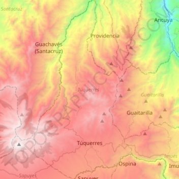
Name: Túquerres topographic map, elevation, terrain.

Location: Túquerres, La Sabana, Nariño, Colombia (1.03693 -77.70235 1.28930 -77.55907)

Average elevation: 2,735 m

Minimum elevation: 1,008 m

Maximum elevation: 4,034 m

Gear up for your next adventure:

🥘Camping Cookware Set - Compact nesting pots and pans for trail cooking
👖Convertible Hiking Pants - Zip-off legs to adapt to changing weather conditions
🛏️Camping Sleeping Mat - Comfortable mats for sleeping outdoors
🔭Compact Binoculars - Lightweight optics for scouting trails and wildlife
🧢Sun Hat - Wide-brim hat for sun protection

As an Amazon Associate, this site earns from qualifying purchases at no extra cost to you.