Geolocate

Ticehurst topographic map

Click on the map to display elevation.

About this map

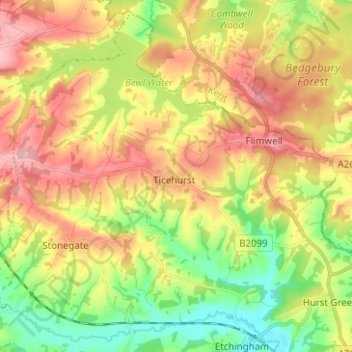
Name: Ticehurst topographic map, elevation, terrain.

Location: Ticehurst, Rother, East Sussex, England, United Kingdom (51.00962 0.34657 51.08365 0.47187)

Average elevation: 81 m

Minimum elevation: 13 m

Maximum elevation: 154 m

Gear up for your next adventure:

🧥Softshell Jacket - Windproof and breathable jacket for hiking
🧣Evaporative Cooling Towel - Beat the heat during intense summer climbs
🥘Camping Cookware Set - Compact nesting pots and pans for trail cooking
🧰Emergency Multi-Tool - Compact multi-tool for outdoor survival
🧶550 Survival Paracord - Versatile utility cord for emergency repairs and rigging

As an Amazon Associate, this site earns from qualifying purchases at no extra cost to you.