Geolocate

Samoëns topographic map

Click on the map to display elevation.

About this map

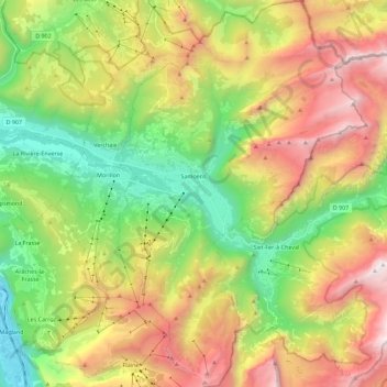
Name: Samoëns topographic map, elevation, terrain.

Location: Samoëns, Bonneville, Upper Savoy, Auvergne-Rhône-Alpes, Metropolitan France, 74340, France (45.99796 6.68282 46.15450 6.82773)

Average elevation: 1,448 m

Minimum elevation: 494 m

Maximum elevation: 2,762 m

Other topographic maps

Click on a map to view its topography, its elevation and its terrain.

Gear up for your next adventure:

🏃Hydration Running Vest - Carry water and maps close to your body for speed
🍽️Titanium Camping Spork - Ultralight and indestructible eating utensil
🧥Insulated Jacket - Keep warm in cold outdoor conditions
Camping Essentials - All-in-one gear for a comfortable camping trip
Backpacking Tent - Lightweight tent for long-distance hiking trips

As an Amazon Associate, this site earns from qualifying purchases at no extra cost to you.