Geolocate

Bayonet Point topographic map

Click on the map to display elevation.

About this map

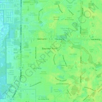
Name: Bayonet Point topographic map, elevation, terrain.

Location: Bayonet Point, Pasco County, Florida, United States (28.30063 -82.70172 28.35014 -82.66590)

Average elevation: 8 m

Minimum elevation: -1 m

Maximum elevation: 13 m

Gear up for your next adventure:

🧢Hiking Hat - Sun-protective and breathable hats for long treks
🦶Hiking Shoe Insoles - Added support for high arches and long days on feet
🧦Thermal Socks - Warm socks for winter hiking or camping
🥾Light Trekking Boots - Supportive boots for multi-day treks
🎒Fully Waterproof Backpack - Total protection for photography gear and electronics

As an Amazon Associate, this site earns from qualifying purchases at no extra cost to you.