
Make a donation
Gear up for your next adventure:
As an Amazon Associate, this site earns from qualifying purchases at no extra cost to you.
Karer See - Lago di Carezza topographic map
Click on the map to display elevation.
Make a donation
Gear up for your next adventure:
As an Amazon Associate, this site earns from qualifying purchases at no extra cost to you.
Karer See - Lago di Carezza
The lake is located in the western Dolomites on the edge of the Latemarwald, just 20 kilometers southeast of Bolzano at 1520 m altitude in the municipality Welschnofen. The nearest settlement is Carezza. The roughly 300 m long and 140 m wide stretch of water is fed by underground springs from the Latemar mountain range.
Make a donation
Gear up for your next adventure:
As an Amazon Associate, this site earns from qualifying purchases at no extra cost to you.
About this map
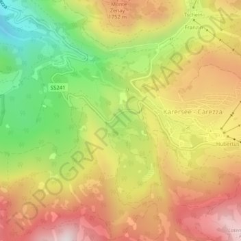
Name: Karer See - Lago di Carezza topographic map, elevation, terrain.
Average elevation: 1,606 m
Minimum elevation: 1,223 m
Maximum elevation: 1,950 m
Make a donation
Gear up for your next adventure:
As an Amazon Associate, this site earns from qualifying purchases at no extra cost to you.