Geolocate

Koothattukulam topographic map

Click on the map to display elevation.

About this map

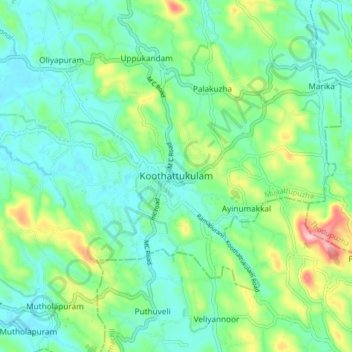
Name: Koothattukulam topographic map, elevation, terrain.

Location: Koothattukulam, Muvattupuzha, Ernakulam, Kerala, 686662, India (9.82160 76.55569 9.90160 76.63569)

Average elevation: 61 m

Minimum elevation: 11 m

Maximum elevation: 196 m

Other topographic maps

Click on a map to view its topography, its elevation and its terrain.

Edapal Chira

India > Kerala > Muvattupuzha > Kakkoor

Average elevation: 26 m

Gear up for your next adventure:

🧢Outdoor Visor - Breathable visor for sunny hikes
🎒Backpack Rain Cover - External shield to keep your entire pack dry
🧤Thermal Hiking Gloves - Grip-enhanced gloves for cold-weather altitude trekking
🛁Quick-Dry Microfiber Towel - Space-saving towel that dries rapidly on the move
🧊Portable Cooler - Keep food and drinks cold during outdoor adventures

As an Amazon Associate, this site earns from qualifying purchases at no extra cost to you.