
Thank you for supporting this site ❤️
Make a donation
Make a donation
Gear up for your next adventure:
As an Amazon Associate, this site earns from qualifying purchases at no extra cost to you.
Songshan District topographic map
Click on the map to display elevation.
Thank you for supporting this site ❤️
Make a donation
Make a donation
Gear up for your next adventure:
As an Amazon Associate, this site earns from qualifying purchases at no extra cost to you.
About this map
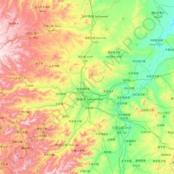
Name: Songshan District topographic map, elevation, terrain.
Location: Songshan District, Chifeng City, Inner Mongolia, China (42.02934 117.78555 42.72020 119.64226)
Average elevation: 947 m
Minimum elevation: 445 m
Maximum elevation: 2,050 m
Thank you for supporting this site ❤️
Make a donation
Make a donation
Gear up for your next adventure:
As an Amazon Associate, this site earns from qualifying purchases at no extra cost to you.