Geolocate

Province of Tarma topographic map

Click on the map to display elevation.

About this map

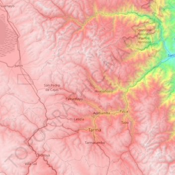
Name: Province of Tarma topographic map, elevation, terrain.

Location: Province of Tarma, Junín, 12651, Peru (-11.60114 -75.97208 -10.90030 -75.40195)

Average elevation: 3,783 m

Minimum elevation: 854 m

Maximum elevation: 5,014 m

Gear up for your next adventure:

💧Collapsible Water Bottle - Space-saving water bottle for outdoor activities
🔨Vehicle Emergency Tool - Safety tool for remote road trips to trailheads
🔭Compact Binoculars - Lightweight optics for scouting trails and wildlife
🧼Biodegradable Camp Soap - Environmentally friendly cleaning for gear and body
🚲Handlebar Phone Mount - View topographic-map.com live while cycling

As an Amazon Associate, this site earns from qualifying purchases at no extra cost to you.