Geolocate

Silicon Valley topographic map

Click on the map to display elevation.

About this map
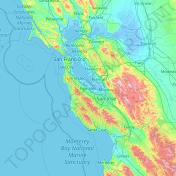
Name: Silicon Valley topographic map, elevation, terrain.

Location: Silicon Valley, Palo Alto, Santa Clara County, California, 94301, United States (36.44300 -123.15452 38.44300 -121.15452)

Average elevation: 118 m

Minimum elevation: -7 m

Maximum elevation: 1,296 m

Other topographic maps

Click on a map to view its topography, its elevation and its terrain.

Gear up for your next adventure:

🧣Merino Neck Gaiter - Protects against wind, sun, and cold at high altitudes
🪑Insulated Seat Pad - Protect your seat from cold rocks and wet logs
🦶Anti-Blister Balm - Prevents friction and hotspots during long ascents
🔭Compact Binoculars - Lightweight optics for scouting trails and wildlife
🐕Hiking Dog Pack - Let your canine companion carry their own water and food

As an Amazon Associate, this site earns from qualifying purchases at no extra cost to you.