Geolocate

Motihari topographic map

Click on the map to display elevation.

Motihari

The topography of Motihari has been described as scenic, with the "stunning beauty" (in classical terms) of Moti Jheel Lake dividing the town in two halves.

Wikipedia (CC-BY-SA 3.0)

About this map

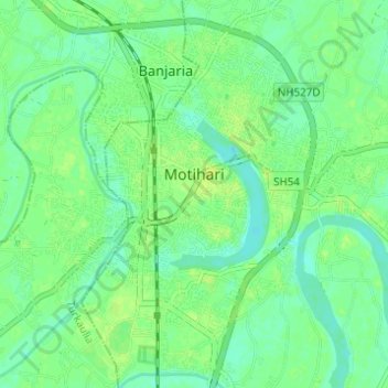
Name: Motihari topographic map, elevation, terrain.

Location: Motihari, East Champaran, Bihar, India (26.62038 84.88740 26.67530 84.94135)

Average elevation: 67 m

Minimum elevation: 60 m

Maximum elevation: 74 m

Gear up for your next adventure:

📷Outdoor Action Camera - Capture high-elevation views and rugged adventures
🧦Thermal Socks - Warm socks for winter hiking or camping
Camping Groundsheet - Protect your tent from moisture and dirt
🥾Waterproof Hiking Shoes - Durable shoes for wet and rugged trails
🔦UV Flashlight - Detect minerals or specific insects in the dark

As an Amazon Associate, this site earns from qualifying purchases at no extra cost to you.