Geolocate

Lychen topographic map

Click on the map to display elevation.

About this map
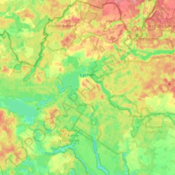
Name: Lychen topographic map, elevation, terrain.

Location: Lychen, Uckermark, Brandenburg, 17279, Germany (53.11012 13.23978 53.28107 13.42973)

Average elevation: 71 m

Minimum elevation: 41 m

Maximum elevation: 113 m

Gear up for your next adventure:

🧥Softshell Jacket - Windproof and breathable jacket for hiking
💧Collapsible Water Bottle - Space-saving water bottle for outdoor activities
🧥Thermal Layer - Insulating layer for cold outdoor conditions
🔋Solar Power Bank - Keep your GPS and devices charged during long outdoor trips
🔦LED Headlamp - Hands-free lighting for early morning starts or late finishes

As an Amazon Associate, this site earns from qualifying purchases at no extra cost to you.