
Thank you for supporting this site ❤️
Make a donation
Make a donation
Gear up for your next adventure:
As an Amazon Associate, this site earns from qualifying purchases at no extra cost to you.
Schongau topographic map
Click on the map to display elevation.
Thank you for supporting this site ❤️
Make a donation
Make a donation
Gear up for your next adventure:
As an Amazon Associate, this site earns from qualifying purchases at no extra cost to you.
About this map
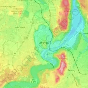
Name: Schongau topographic map, elevation, terrain.
Location: Schongau, Landkreis Weilheim-Schongau, Bavaria, 86956, Germany (47.78384 10.85577 47.84117 10.93225)
Average elevation: 721 m
Minimum elevation: 655 m
Maximum elevation: 814 m
Thank you for supporting this site ❤️
Make a donation
Make a donation
Gear up for your next adventure:
As an Amazon Associate, this site earns from qualifying purchases at no extra cost to you.
Other topographic maps
Click on a map to view its topography, its elevation and its terrain.
Bürstenstiel
Germany > Bavaria > Landkreis Weilheim-Schongau > Bernbeuren > Bürstenstiel
Average elevation: 802 m