Geolocate

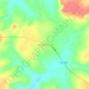
Alvorada topographic map

Click on the map to display elevation.

About this map

Name: Alvorada topographic map, elevation, terrain.

Location: Alvorada, Região Geográfica Imediata de Gurupi, Região Geográfica Intermediária de Gurupi, Tocantins, North Region, 77480-000, Brazil (-12.64200 -49.33611 -12.17500 -48.90250)

Average elevation: 268 m

Minimum elevation: 209 m

Maximum elevation: 423 m

Other topographic maps

Click on a map to view its topography, its elevation and its terrain.
Praia do Segredo

Brazil > Tocantins > Lajeado

Average elevation: 209 m

Campina Verde

Brazil > Tocantins

Average elevation: 271 m

Gear up for your next adventure:

🛰️Satellite Messenger - Emergency communication for areas with no cell service
🚲Handlebar Phone Mount - View topographic-map.com live while cycling
🧥Waterproof Pants - Keep dry during rainy hiking conditions
💧Collapsible Water Bottle - Space-saving water bottle for outdoor activities
💡LED Headlamp - Hands-free illumination for night hiking and camping

As an Amazon Associate, this site earns from qualifying purchases at no extra cost to you.