Geolocate

Glen Alpine topographic map

Click on the map to display elevation.

About this map
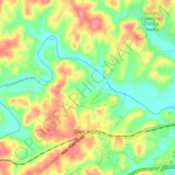
Name: Glen Alpine topographic map, elevation, terrain.

Location: Glen Alpine, Burke County, North Carolina, 28628, United States (35.71594 -81.81652 35.76841 -81.76566)

Average elevation: 347 m

Minimum elevation: 308 m

Maximum elevation: 397 m

Other topographic maps

Click on a map to view its topography, its elevation and its terrain.

Pinnacle

United States > North Carolina > Burke County

Average elevation: 656 m

Gear up for your next adventure:

🔭Compact Monocular - One-handed bird watching and trail spotting
🥾Lightweight Hiking Shoes - Comfortable shoes for day hikes
🦯Trekking Poles - Reduced impact on joints for steep topographic climbs
⛺Tent Footprint - Protect tent floor and increase durability
🔪Outdoor Multitool - Versatile tool for repairs and food prep in the wild

As an Amazon Associate, this site earns from qualifying purchases at no extra cost to you.