
Thank you for supporting this site ❤️
Make a donation
Make a donation
Gear up for your next adventure:
As an Amazon Associate, this site earns from qualifying purchases at no extra cost to you.
Budhitola topographic map
Click on the map to display elevation.
Thank you for supporting this site ❤️
Make a donation
Make a donation
Gear up for your next adventure:
As an Amazon Associate, this site earns from qualifying purchases at no extra cost to you.
About this map
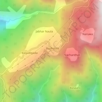
Name: Budhitola topographic map, elevation, terrain.
Location: Budhitola, Godawari, Kailali, Sudurpashchim Pradesh, Nepal (28.92105 80.57889 28.94105 80.59889)
Average elevation: 1,087 m
Minimum elevation: 601 m
Maximum elevation: 1,519 m
Thank you for supporting this site ❤️
Make a donation
Make a donation
Gear up for your next adventure:
As an Amazon Associate, this site earns from qualifying purchases at no extra cost to you.