Geolocate

Tittmoning topographic map

Click on the map to display elevation.

About this map

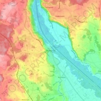
Name: Tittmoning topographic map, elevation, terrain.

Location: Tittmoning, Landkreis Traunstein, Bavaria, 84529, Germany (48.02217 12.72765 48.10217 12.80765)

Average elevation: 433 m

Minimum elevation: 357 m

Maximum elevation: 526 m

Gear up for your next adventure:

🥾Mountaineering Boots - Supportive boots for climbing and high-altitude hiking
Lightweight Camping Tent - Portable shelter optimized for Canadian backcountry camping
🔦LED Headlamp - Hands-free lighting for early morning starts or late finishes
🌡️Emergency Mylar Blankets - Compact thermal protection for unexpected nights outdoors
🥾All-Terrain Hiking Boots - Versatile boots for varied hiking conditions

As an Amazon Associate, this site earns from qualifying purchases at no extra cost to you.