Geolocate

Nicolet topographic map

Click on the map to display elevation.

About this map

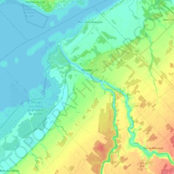
Name: Nicolet topographic map, elevation, terrain.

Location: Nicolet, Nicolet-Yamaska, Centre-du-Québec, Quebec, Canada (46.14130 -72.73250 46.28321 -72.51214)

Average elevation: 20 m

Minimum elevation: 1 m

Maximum elevation: 65 m

Nicolet-Yamaska trails, hiking, mountain biking, running and outdoor activities

Gear up for your next adventure:

🥾Durable Hiking Shoes - Long-lasting shoes for frequent hiking
Camping Tent - Weather-resistant tents suitable for 2 to 6 people
👟Trail Running Shoes - Agile footwear for fast-paced topographic exploration
🛏️Sleeping Bag - Warm and compact sleeping bags for outdoor camping
🛶Kayak Accessories - Essential gear for safe and fun kayaking adventures

As an Amazon Associate, this site earns from qualifying purchases at no extra cost to you.