Geolocate

Roldanillo topographic map

Click on the map to display elevation.

About this map

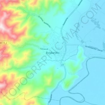
Name: Roldanillo topographic map, elevation, terrain.

Location: Roldanillo, Norte, Valle del Cauca, 761550, Colombia (4.36912 -76.19437 4.44912 -76.11437)

Average elevation: 1,070 m

Minimum elevation: 907 m

Maximum elevation: 1,670 m

Gear up for your next adventure:

🥾Waterproof Hiking Shoes - Durable shoes for wet and rugged trails
🍽️Titanium Camping Spork - Ultralight and indestructible eating utensil
🔥Camping Stove - Portable stoves to cook outdoors with ease
🧥Softshell Jacket - Windproof and breathable jacket for hiking
🧴Bear Spray Holster - Quick-access carry for essential Canadian wilderness safety

As an Amazon Associate, this site earns from qualifying purchases at no extra cost to you.