
Bristol topographic map
Click on the map to display elevation.
Bristol
Like much of the rest of the state, Bristol has a humid subtropical climate (Köppen climate classification: Cfa), although with significantly cooler temperatures, especially in the summer, due to elevation; it is part of USDA hardiness zone 6b, with areas to the southwest falling in zone 7a. The normal monthly mean temperature ranges from 35.2 °F (1.8 °C) in January to 74.6 °F (23.7 °C) in July, while, on average, 8.8 days have temperatures at or below freezing and 17 days with highs at or above 90 °F (32 °C) per year. The all-time record low is −21 °F (−29 °C), set on January 21, 1985, while the all-time record high is 103 °F (39 °C), set on June 30, 2012.
About this map
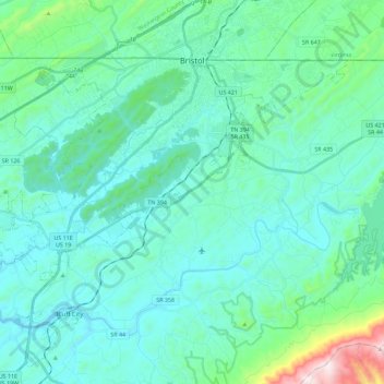
Name: Bristol topographic map, elevation, terrain.
Average elevation: 543 m
Minimum elevation: 417 m
Maximum elevation: 1,282 m