Geolocate

Four Corners topographic map

Click on the map to display elevation.

About this map

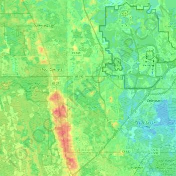
Name: Four Corners topographic map, elevation, terrain.

Location: Four Corners, Osceola County, Florida, United States (28.23254 -81.70899 28.43483 -81.58551)

Average elevation: 34 m

Minimum elevation: 17 m

Maximum elevation: 70 m

Gear up for your next adventure:

🧭GPS Outdoor Watch - Smart watch for navigation and fitness tracking in nature
🧣Merino Neck Gaiter - Protects against wind, sun, and cold at high altitudes
🔦UV Flashlight - Detect minerals or specific insects in the dark
🥾Trail Hiking Socks - Comfortable socks to prevent blisters and fatigue
👟Trail Running Shoes - Agile footwear for fast-paced topographic exploration

As an Amazon Associate, this site earns from qualifying purchases at no extra cost to you.