
Phú Lộc District topographic map
Interactive map
Click on the map to display elevation.
About this map
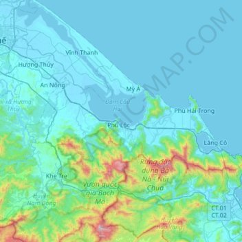
Name: Phú Lộc District topographic map, elevation, terrain.
Location: Phú Lộc District, Thừa Thiên Huế Province, 53000, Vietnam (16.16486 107.64821 16.41164 108.19479)
Average elevation: 169 m
Minimum elevation: -2 m
Maximum elevation: 1,660 m