Geolocate

Marion topographic map

Click on the map to display elevation.

About this map
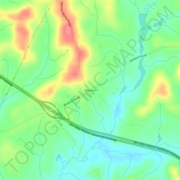
Name: Marion topographic map, elevation, terrain.

Location: Marion, Twiggs County, Georgia, United States (32.64237 -83.45712 32.68237 -83.41712)

Average elevation: 115 m

Minimum elevation: 88 m

Maximum elevation: 159 m

Other topographic maps

Click on a map to view its topography, its elevation and its terrain.

Danville

United States > Georgia > Twiggs County

Average elevation: 133 m

Jeffersonville

United States > Georgia > Twiggs County

Average elevation: 148 m

Gear up for your next adventure:

🩹Moleskin Blister Pads - Direct protection for painful foot pressure points
🧤Thermal Hiking Gloves - Grip-enhanced gloves for cold-weather altitude trekking
🥾Hiking Gaiters - Protect legs and shoes from mud, snow, and debris
🌬️Windproof Camp Stove - Efficient cooking even on exposed mountain peaks
🥾Hiking Leggings - Comfortable leggings for outdoor activities

As an Amazon Associate, this site earns from qualifying purchases at no extra cost to you.