
Thank you for supporting this site ❤️
Make a donation
Make a donation
Gear up for your next adventure:
As an Amazon Associate, this site earns from qualifying purchases at no extra cost to you.
Lac-Pikauba topographic map
Click on the map to display elevation.
Thank you for supporting this site ❤️
Make a donation
Make a donation
Gear up for your next adventure:
As an Amazon Associate, this site earns from qualifying purchases at no extra cost to you.
About this map
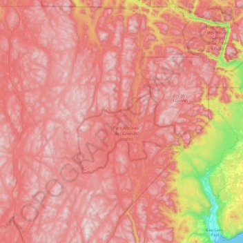
Name: Lac-Pikauba topographic map, elevation, terrain.
Location: Lac-Pikauba, Charlevoix, Capitale-Nationale, Quebec, Canada (47.43253 -71.41161 47.99999 -70.52705)
Average elevation: 736 m
Minimum elevation: 0 m
Maximum elevation: 1,141 m
Charlevoix trails, hiking, mountain biking, running and outdoor activities
Thank you for supporting this site ❤️
Make a donation
Make a donation
Gear up for your next adventure:
As an Amazon Associate, this site earns from qualifying purchases at no extra cost to you.
Other topographic maps
Click on a map to view its topography, its elevation and its terrain.