Geolocate

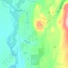
Matanuska topographic map

Click on the map to display elevation.

About this map

Name: Matanuska topographic map, elevation, terrain.

Location: Matanuska, Matanuska-Susitna, Alaska, United States (61.52194 -149.24972 61.56194 -149.20972)

Average elevation: 15 m

Minimum elevation: 1 m

Maximum elevation: 58 m

Other topographic maps

Click on a map to view its topography, its elevation and its terrain.
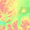
Glacier View

United States > Alaska > Matanuska-Susitna

Average elevation: 1,127 m

Talkeetna

United States > Alaska > Matanuska-Susitna > Talkeetna

Average elevation: 178 m

Halfway Lake

United States > Alaska > Matanuska-Susitna

Average elevation: 718 m

Gear up for your next adventure:

👟Sport Hiking Sandals - Breathable footwear for water crossings and camp rest
👟Trail Running Shoes - Agile footwear for fast-paced topographic exploration
🧥Waterproof Pants - Keep dry during rainy hiking conditions
🥾Light Hiking Boots - Lightweight and comfortable boots for day hikes
⛺Backpacking Tent - Lightweight tent for long-distance hiking trips

As an Amazon Associate, this site earns from qualifying purchases at no extra cost to you.