Geolocate

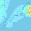
Cabaluay topographic map

Click on the map to display elevation.

About this map

Name: Cabaluay topographic map, elevation, terrain.

Location: Cabaluay, Zamboanga City, Zamboanga Peninsula, 7000, Philippines (6.97467 122.15529 7.01467 122.19529)

Average elevation: 11 m

Minimum elevation: -2 m

Maximum elevation: 78 m

Other topographic maps

Click on a map to view its topography, its elevation and its terrain.

Sacol Island

Philippines > Zamboanga City

Average elevation: 6 m

Vitali River

Philippines > Zamboanga City > Mangusu

Average elevation: 27 m

Sinunug Island

Philippines > Zamboanga City

Average elevation: 0 m

Plaza Pershing

Philippines > Zamboanga City

Average elevation: 4 m

Gear up for your next adventure:

🥘Camping Cookware Set - Compact nesting pots and pans for trail cooking
🏕️Camping Hammock - Integrated protection for sleeping between trees
🥾Trail Hiking Boots - Supportive boots for rough trails
🧴Outdoor Sunscreen - High SPF protection for high-altitude UV exposure
🥾Trekking Boots - Durable boots for long-distance trekking

As an Amazon Associate, this site earns from qualifying purchases at no extra cost to you.