Geolocate

Meppadi topographic map

Click on the map to display elevation.

About this map

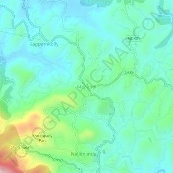
Name: Meppadi topographic map, elevation, terrain.

Location: Meppadi, Vythiri, Wayanad, Kerala, 673577, India (11.53306 76.11220 11.57306 76.15220)

Average elevation: 857 m

Minimum elevation: 765 m

Maximum elevation: 1,176 m

Gear up for your next adventure:

🔨Vehicle Emergency Tool - Safety tool for remote road trips to trailheads
🦶Anti-Blister Balm - Prevents friction and hotspots during long ascents
🧥Waterproof Hiking Jacket - Protect yourself from rain and wind while hiking
🔋Emergency Crank Radio - Weather alerts and power without needing batteries
🧤Insulated Winter Gloves - Heavy-duty protection for sub-zero Canadian adventures

As an Amazon Associate, this site earns from qualifying purchases at no extra cost to you.