
Hayden topographic map
Click on the map to display elevation.
Hayden
According to the United States Census Bureau, the city has a total area of 9.61 square miles (24.89 km2), of which 9.60 square miles (24.86 km2) is land and 0.01 square miles (0.03 km2) is water. It lies at the southwestern end of Hayden Lake, and the elevation of the city is 2,287 feet (697 m) above sea level.
About this map
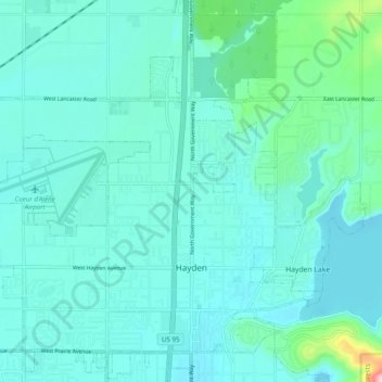
Name: Hayden topographic map, elevation, terrain.
Location: Hayden, Kootenai County, Idaho, United States (47.74169 -116.85115 47.80257 -116.75338)
Average elevation: 709 m
Minimum elevation: 676 m
Maximum elevation: 928 m