Queens topographic map
Click on the map to display elevation.
Queens
Many of the village street grids of Queens had only worded names, some were numbered according to local numbering schemes, and some had a mix of words and numbers. In the early 1920s, a "Philadelphia Plan" was instituted to overlay one numbered system upon the whole borough. The Topographical Bureau, Borough of Queens, worked out the details. Subway stations were only partly renamed, and some, including those along the IRT Flushing Line (7 and <7> trains), now share dual names after the original street names. In 2012, some numbered streets in the Douglaston Hill Historic District were renamed to their original names, with 43rd Avenue becoming Pine Street.
About this map
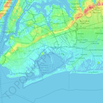
Name: Queens topographic map, elevation, terrain.
Location: Queens, Queens County, New York, United States (40.49212 -74.04378 40.81214 -73.70023)
Average elevation: 11 m
Minimum elevation: -8 m
Maximum elevation: 109 m
Other topographic maps
Click on a map to view its topography, its elevation and its terrain.