Geolocate

Zungoli topographic map

Click on the map to display elevation.

About this map
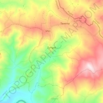
Name: Zungoli topographic map, elevation, terrain.

Location: Zungoli, Avellino, Campania, Italy (41.09876 15.18396 41.14703 15.26378)

Average elevation: 663 m

Minimum elevation: 415 m

Maximum elevation: 929 m

Other topographic maps

Click on a map to view its topography, its elevation and its terrain.

Troiani

Italy > Campania > Avellino > Sala

Average elevation: 601 m

Gear up for your next adventure:

🔪Outdoor Multitool - Versatile tool for repairs and food prep in the wild
🥾Lightweight Hiking Shoes - Comfortable shoes for day hikes
🛶Waterproof Dry Bags - Keep electronics and clothes dry during river crossings
👟Trail Running Shoes - Agile footwear for fast-paced topographic exploration
🥾Approach Boots - Comfortable boots for hiking and climbing approaches

As an Amazon Associate, this site earns from qualifying purchases at no extra cost to you.