
Hidden Lake topographic map
Click on the map to display elevation.
About this map
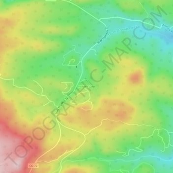
Name: Hidden Lake topographic map, elevation, terrain.
Location: Hidden Lake, Boulder County, Colorado, United States (40.08999 -105.49861 40.12999 -105.45861)
Average elevation: 2,679 m
Minimum elevation: 2,556 m
Maximum elevation: 2,833 m
Other topographic maps
Click on a map to view its topography, its elevation and its terrain.
Nederland
United States > Colorado > Boulder County
In 1873 the Caribou Mine, at an elevation of roughly 10,000 feet (3,000 m) and 6 miles (10 km) northwest of the town, was sold to the Mining Company Nederland from the Netherlands. The high elevation meant fierce winds and deep winter snow, so the new owners of the mine decided that it was beneficial to bring…
Average elevation: 2,578 m