Geolocate

Gore topographic map

Click on the map to display elevation.

About this map

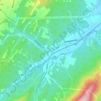
Name: Gore topographic map, elevation, terrain.

Location: Gore, Frederick County, Virginia, 22637, United States (39.24399 -78.35195 39.28399 -78.31195)

Average elevation: 279 m

Minimum elevation: 200 m

Maximum elevation: 522 m

Gear up for your next adventure:

💧Filtered Water Bottle - Safe drinking water on the go
🥾Mountain Hiking Shoes - Shoes with superior grip for mountainous terrain
🔭Compact Binoculars - Lightweight optics for scouting trails and wildlife
📷Outdoor Action Camera - Capture high-elevation views and rugged adventures
🧴Sunscreen SPF - Broad-spectrum sunscreen for outdoor activities

As an Amazon Associate, this site earns from qualifying purchases at no extra cost to you.